Blog
Budhi Gandaki River: The Complete Guide to Nepal's Manaslu Valley Lifeline
Budhi Gandaki trek, Manaslu Circuit, Budhi Gandaki hydropower project, Arughat, Tsum Valley, Gorkha river
Budhi Gandaki trek, Manaslu Circuit, Budhi Gandaki hydropower project, Arughat, Tsum Valley, Gorkha river
The Budhi Gandaki River is a Himalayan river in central Nepal. It begins in the high country of the Manaslu region, runs south through Gorkha District, and ends where it meets the Trishuli River at Benighat. Along the way it carves one of Nepal's most dramatic valleys, which is also the route of the famous Manaslu Circuit Trek. It is also the site of Nepal's largest planned storage hydropower project, a 1,200 MW dam.
| Fact | Detail |
|---|---|
| Country | Nepal |
| Main districts | Gorkha and Dhading |
| Starts near | Manaslu Himal, close to Samagaun |
| Ends at | Confluence with the Trishuli River at Benighat |
| Approximate length | Around 150 km |
| Drainage basin | Roughly 5,000 km², mostly in Nepal, with a small part in China |
| River system | Trishuli, then Narayani (Gandaki) |
| Famous for | Manaslu Circuit Trek, Tsum Valley access, proposed 1,200 MW dam |
Some of those numbers vary a little between sources. Rivers in the Himalaya are surveyed less often than you'd think, and different agencies measure differently. Treat the length as "about 150 km" rather than an exact figure.
Most people first hear about the Budhi Gandaki in one of two ways. Either they're planning a trek around Mount Manaslu, or they've read a news story about a very big, very debated dam.
Both are the same river.
The Budhi Gandaki is a mid-sized mountain river by Himalayan standards. It isn't the Koshi or the Karnali, and it doesn't have their fame. But it drains an enormous, steep, glaciated chunk of central Nepal. According to a regional reference, it flows through Gorkha District, forms the border with Dhading in its lower stretch, and joins the Trishuli River at Benighat. From there the water travels on toward the Narayani, the name the Gandaki takes lower down in the Terai. Its drainage basin covers around 5,000 square kilometres, mostly inside Nepal but with a portion reaching into China.
If you like your geography with a bit of story, think of it this way: snow falls on the shoulders of the world's eighth-highest mountain, melts into a glacial stream, gathers side rivers from hidden valleys, tumbles through gorges where trails hang off cliffs, and finally slides into the Trishuli on the road between Kathmandu and Pokhara. That's the Budhi Gandaki.
The river begins in the Manaslu Himal, the same massif that holds Mount Manaslu (8,163 m). One reference places the source near Samagaun, the big Nubri village that trekkers use as their acclimatization base. That fits what you see on the ground: meltwater from the glaciers around Manaslu and the surrounding peaks collects into streams and feeds the upper valley.
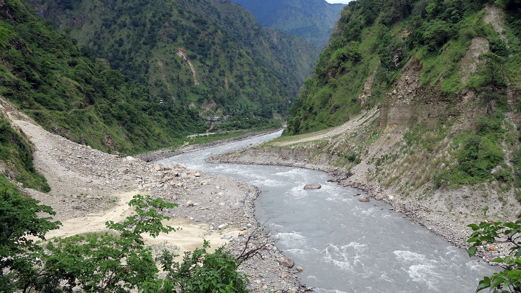
Even the upper river doesn't stay small for long. Every side valley adds another tributary. By the time you're walking through the lower stretches, the Budhi Gandaki is a wide, loud, grey-green river with real muscle, the kind you can hear from the trail long before you see it.
The river ends at Benighat, where it flows into the Trishuli. This is right on the border of Dhading and Gorkha districts. Beyond that meeting point, the combined flow continues south. Further downstream the Trishuli joins the Kali Gandaki, and the river becomes known as the Narayani. One source puts that name change around the confluence with the Trishuli at Devghat in Chitwan.
So a raindrop that lands near Manaslu can end up in the Ganges, and eventually in the Bay of Bengal, without ever leaving the same drainage system. That's a nice thing to think about when you're standing on a suspension bridge at 2,000 metres.
The name is usually translated as "old Gandaki." Budhi (बूढी) carries the sense of old or aged in Nepali, and Gandaki is the great river system of central Nepal. It's a way of distinguishing this river from its better-known siblings, the Kali Gandaki, the Marsyangdi and others in the same family.
You'll see the river spelled several ways: Budhi Gandaki, Buddhi Gandaki, Budhigandaki, Burhi Gandaki. All of them refer to the same river in Nepal. One warning for anyone researching online: there's also a Burhi Gandak in Bihar, India, which is a completely different river. If your search results start talking about Samastipur, you've wandered off the Himalaya.
The valley changes character as you climb, and that's a big part of its appeal.
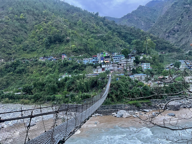
The lower valley (about 500 to 1,500 m). This is subtropical, green and humid. You'll see terraced rice fields, banana plants, bamboo groves, waterfalls that spill straight off the hillside, and villages with tin-roofed houses. The river is wide and fast. Trails here often follow the riverbank or cut across the steep slope above it.
The middle valley (about 1,500 to 2,800 m). The gorge tightens. Trails cross suspension bridges, and in some places they climb through cliffs. Forests shift to oak and rhododendron, and the air cools noticeably. This is where the valley starts to feel truly Himalayan.
The upper valley (about 2,800 to 3,600 m and beyond). The landscape opens into wide, cold, high-altitude terrain. You see stone houses, prayer flags, mani walls, yak pastures and glacial moraines. The peaks stop being distant background and start being right above you.
Few trekking valleys in Nepal show such a complete change in climate, vegetation and culture in such a short distance.
For most visitors, the Budhi Gandaki is the Manaslu Circuit Trek. It's often described as a quieter alternative to the Annapurna Circuit, and it earns that reputation.
Trekkers usually start from the Arughat and Soti Khola area in Gorkha after a long drive from Kathmandu. From there the trail follows the river upstream through a string of villages. The typical sequence looks like this:
Most itineraries take 12 to 16 days, depending on the start point and how many rest days you build in. Because roads have been slowly creeping further up the valley in recent years, exact start and end points shift. Ask your trekking operator what's current before you commit to an itinerary.
Fewer crowds. Manaslu is a restricted area, so numbers are lower than on the more famous circuits. On a good day you might see only a handful of other groups.
A real cultural transition. Down low, you walk among Hindu and Gurung communities. Higher up, the valley becomes strongly Tibetan Buddhist in feel, with gompas, chortens and prayer wheels everywhere.
Big mountains, not just big views. Manaslu itself dominates the upper valley, and you'll get close-up views of the surrounding Himalayan giants on the way to the pass.
The pass itself. Crossing Larkya La at 5,106 metres is the emotional peak of the trek. It's a long, cold, early-morning day, and the views at the top are the payoff.
Manaslu is a restricted area, so you need special permits. In practice this means a Restricted Area Permit, a Manaslu Conservation Area Permit, and, near the end of the route, an Annapurna Conservation Area Permit. You'll also need to travel with a licensed guide, and the rules generally require at least two trekkers. Fees and requirements change, so check with a registered trekking agency or the Nepal Tourism Board for current details rather than trusting an old blog post, including this one.
Autumn (October to November) is the classic season: stable weather, clear skies and crisp mornings. Spring (March to May) is also excellent, with rhododendrons blooming in the middle valley. Winter can work for the lower sections, but Larkya La is often snowbound and dangerous. The monsoon (June to September) brings heavy rain, leeches and landslides that can wipe out sections of trail.
One of the Budhi Gandaki's tributaries, the Siyar Khola, drains the Tsum Valley, a remote pocket of Tibetan-influenced culture tucked against the border. Trekkers can branch off the main Manaslu route and explore it as an add-on or as a trek of its own.
Tsum is known for old monasteries, mani walls, traditional villages and a strong sense of being somewhere protected from the modern world. It's the kind of place where you stay in a family-run lodge, drink butter tea by a stove and realize halfway through the evening that you haven't checked your phone in hours. If you have the time, adding it turns a great trek into a memorable one.
Rivers shape the people who live beside them, and the Budhi Gandaki is no exception.
In the lower valley, communities include Gurung, Chhetri, Brahmin and others who farm terraced fields and raise livestock. Life follows the seasons: planting, harvest, festivals. Higher up, the population is mostly Tibetan-descended Buddhist communities such as the Nubri and Tsum peoples. Their lives are shaped by altitude, trade routes to Tibet, yak herding, barley farming and a rich religious tradition.
If you trek here, a few small courtesies go a long way:
The 2015 earthquake, centred in Gorkha, hit this region hard. Many villages have rebuilt, and tourism has been part of that recovery. It's worth remembering that when you're deciding whether to haggle over a few rupees.
The river flows through a huge range of habitats, from warm lowland forest to alpine tundra. That variety is why the Manaslu area is protected as the Manaslu Conservation Area.
With luck and patience, visitors may spot Himalayan tahr, langur monkeys, and many bird species along the trail. The snow leopard lives in the high country, but honestly, you're unlikely to see one. Most people who work in the region will tell you the same thing: the cat sees you long before you see it. Blue sheep are more commonly spotted on the upper slopes. Forest birdlife is excellent in the lower and middle valley, especially in the early morning.
The river itself is more than scenery. It feeds farmland, supports fish and other aquatic life, and provides water to communities downstream. Any big change to the river, whether from climate, roads or dams, ripples outward through everything that depends on it.
You can't write honestly about this river without talking about the dam.
The Budhi Gandaki Hydroelectric Project is a proposed storage-type power plant with a planned capacity of 1,200 MW. It would sit on the river roughly 2 km upstream of the Trishuli confluence, around 55 km west of Kathmandu, or 80 km by road. The design calls for a very large reservoir, with one source listing a maximum length of about 45 km and a surface area near 50 square kilometres. Published figures for the dam height differ between sources, but it would be well over 200 metres, among the tallest in Nepal.
Storage matters because most Nepali hydropower is run-of-river. It produces plenty in the monsoon but far less in the dry winter, exactly when demand is high. A big reservoir can hold water and release it when it's needed, which is why supporters call Budhi Gandaki a potential game-changer for energy security.
The project has a long and frustrating history. Its early study dates back decades, and in the years since it has gone through changes of developer, funding models and political direction. What's new is real movement. In early 2026, reports said that the Cabinet approved the financial investment framework again in Falgun, and the energy ministry then sent its approval letter to the project company on 9 Chaitra. The base cost has been cited at around USD 2.77 billion (roughly NPR 374 billion), with a planned split of 70 percent debt and 30 percent equity.
By April 2026, the project company had invited bids for building a camp and a bridge linking Dhading and Gorkha, which is preparatory work rather than the dam itself. The company's CEO has said the plan is to start construction by contracting for the main project from January 2028. As with any mega-project, timelines can slip, so it's worth checking recent news if you're following this closely.
A few practical truths about the Budhi Gandaki valley:
Landslides are part of life. Steep slopes, heavy rain and earthquake-loosened rock mean trails and roads can be damaged, especially in the monsoon. Locals rebuild sections again and again.
Weather can turn fast. Even in the trekking seasons, mountain weather changes quickly. Bring layers, rain gear and a flexible schedule.
Altitude is the main health risk. Samagaun sits around 3,500 m, and the pass is above 5,000 m. Follow the usual advice: ascend gradually, drink plenty of water, take rest days, and descend if symptoms of altitude sickness get worse.
Climate change is visible. Glaciers in the Himalaya are retreating, and changing melt patterns affect both water supply and glacial-lake risk. Communities along the upper valley are already noticing the difference.
From Kathmandu, the usual approach is by road toward Gorkha District and then up to Arughat and the trailhead villages. The drive is long and often bumpy, especially on the final stretches. Many people use a private jeep arranged through a trekking agency. Shared local buses are cheaper, but slower and less comfortable.
If you're only interested in seeing the river's lower course rather than trekking, you can spot the confluence area from the Prithvi Highway near Benighat and Malekhu, where the road runs beside the Trishuli. It's a great place for a tea stop and a look at where the Budhi Gandaki's water joins the larger river.
Where is the Budhi Gandaki River?
It's in central Nepal, mainly in Gorkha District, with its lower course forming part of the border with Dhading District. It starts in the Manaslu Himal and ends at its confluence with the Trishuli River at Benighat.
How long is the Budhi Gandaki River?
Roughly 150 km, according to one geographic reference. Figures vary slightly by source because of differences in measurement and where the river's headwaters are defined.
What does Budhi Gandaki mean?
The name is generally understood as "old Gandaki." It distinguishes this river from other rivers in the Gandaki system, such as the Kali Gandaki.
Is the Budhi Gandaki the same as the Manaslu trek river?
Yes. The Manaslu Circuit Trek follows the Budhi Gandaki upstream for much of its route, from lower villages like Soti Khola and Machha Khola up to Samagaun and beyond.
Which river does the Budhi Gandaki flow into?
It flows into the Trishuli River at Benighat. The Trishuli continues on and later becomes part of the Narayani (Gandaki) system.
What is the Budhi Gandaki Hydropower Project?
It's a proposed 1,200 MW storage hydropower project on the river, near its confluence with the Trishuli. It would be one of Nepal's largest, with pre-construction work moving forward and main construction contracting planned for around 2028.
Do I need a permit to trek along the Budhi Gandaki?
For the Manaslu Circuit, yes. You need a Restricted Area Permit and conservation area permits, and you must trek with a licensed guide. Check current rules and fees with a registered agency before you plan.
When is the best time to visit?
October to November and March to May are the best windows, with clearer skies and more stable conditions. The monsoon brings landslide risk, and winter makes the high pass difficult.
Is the Budhi Gandaki River good for rafting?
Some stretches have strong currents and are used for rafting, but it's a serious river with powerful water. Only go with an experienced, licensed operator, and check current conditions.
The Budhi Gandaki isn't the biggest river in Nepal, and it doesn't have the fame of the Kali Gandaki or the Koshi. But it holds a strange and beautiful mix of things: glaciers and rice terraces, Tibetan monasteries and Gurung villages, one of the world's great trekking routes, and a giant dam that could change the country's energy future.
Whether you come as a trekker, a researcher, a student or just a curious reader, it's a river that rewards attention. It reminds you that Nepal's story isn't only told on the summit of Everest. It's told in valleys like this one, where water, mountains and people have been shaping each other for centuries.
If you're planning a visit, go slowly, travel respectfully and listen to the people who live there. They know this river better than any blog ever will.