Blog
Manaslu Circuit Trek Altitude
Explore Manaslu Circuit Trek altitude, elevation by stop, Larkya La Pass height, acclimatization, altitude sickness, and high-altitude trekking tips.
Explore Manaslu Circuit Trek altitude, elevation by stop, Larkya La Pass height, acclimatization, altitude sickness, and high-altitude trekking tips.
If you are planning the Manaslu Circuit Trek, understanding the altitude is one of the most important parts of your preparation. This is not a trek where you simply walk higher every day and hope for the best. The route takes you from the warm, green valleys of Nepal to an altitude of 5,106 meters (16,752 feet) at Larkya La Pass, with several nights spent above 3,000 meters.
The good news is that the Manaslu Circuit is a gradual journey. You start at a relatively low elevation and gain altitude step by step as you move deeper into the Himalayas. With a properly planned itinerary, acclimatization days, a comfortable walking pace, and good preparation, most physically fit trekkers can handle the elevation.
The biggest challenge comes during the final section, when you leave Dharamsala at around 4,460 meters and climb toward Larkya La Pass. The air is thin, the temperature can be very cold, and the walking becomes slower. But reaching the top and seeing the spectacular Himalayan landscape on both sides of the pass is one of the most memorable moments of the entire trek.
This guide covers the Manaslu Circuit Trek altitude by day and location, the highest points, acclimatization, altitude sickness, elevation profile, preparation tips, and everything you should know before trekking above 4,000 meters.
Here are the major elevation points along the classic Manaslu Circuit route:
| Trekking Location | Approx. Altitude | Approx. Feet |
|---|---|---|
| Machha Khola | 900 m | 2,953 ft |
| Jagat | 1,340 m | 4,396 ft |
| Deng | 1,860 m | 6,102 ft |
| Namrung | 2,630 m | 8,628 ft |
| Lho | 3,180 m | 10,433 ft |
| Sama Gaun | 3,530 m | 11,581 ft |
| Samdo | 3,875 m | 12,713 ft |
| Dharamsala | 4,460 m | 14,633 ft |
| Larkya La Pass | 5,106 m | 16,752 ft |
| Bimthang | 3,590 m | 11,778 ft |
Elevations can vary slightly between maps, GPS devices, and trekking itineraries.
The highest point of the Manaslu Circuit Trek is Larkya La Pass, at approximately 5,106 meters (16,752 feet).
Larkya La is the high mountain pass connecting the Manaslu region with the Marsyangdi Valley. Although the pass is not a technical climbing route under normal conditions, reaching it requires a long and demanding day at high altitude.
Most trekkers spend the previous night at Dharamsala, also called Larkya Phedi, at approximately 4,460 meters. From there, the trail climbs steadily toward the pass.
The crossing usually begins very early in the morning. Starting early gives you more time to complete the pass before weather conditions change and allows you to make the long descent toward Bimthang.
For many trekkers, standing at the prayer flags of Larkya La after several days in the mountains is the highlight of the Manaslu Circuit.
One of the best things about the Manaslu Circuit is the way the altitude changes throughout the journey.
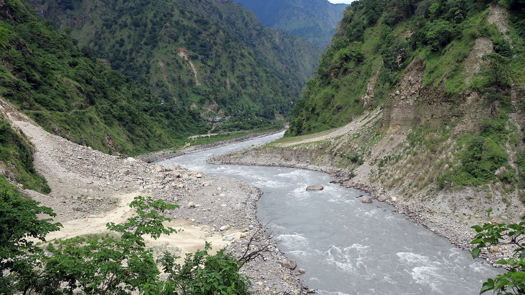
The trek does not immediately throw you into a high-altitude environment. Instead, the route gradually follows the Budhi Gandaki Valley from the lower hills toward the Tibetan-influenced highlands.
The approximate progression looks like this:
Machha Khola – 900 m → Jagat – 1,340 m → Deng – 1,860 m → Namrung – 2,630 m → Lho – 3,180 m → Sama Gaun – 3,530 m → Samdo – 3,875 m → Dharamsala – 4,460 m → Larkya La – 5,106 m → Bimthang – 3,590 m
This gradual elevation gain is important because your body needs time to adjust to the decreasing oxygen levels.
You will notice that walking becomes noticeably slower once you are above 3,000 meters. That is normal. A short uphill section that would take only a few minutes at lower elevations can feel surprisingly difficult at 4,000 meters.
Don't fight it. Slow down, breathe steadily, and let your body adjust.
Machha Khola is one of the most common starting points for the Manaslu Circuit Trek.
At around 900 meters, the environment still feels warm and subtropical. The trail passes through green hills, rivers, waterfalls, suspension bridges, and small villages.
Altitude is not usually a major concern here. Instead, the first few days are about getting used to long days of walking.
Even though the elevation is low, don't push yourself too hard at the beginning. The Manaslu Circuit is a long-distance trek, so saving energy for the higher sections is important.
The trail continues upward to Jagat, situated at approximately 1,340 meters.
Jagat is the official entry area for the Manaslu Conservation Area and has a traditional stone-paved village atmosphere.
You are still at a relatively low altitude, but the trail itself can be physically demanding. There are plenty of uphill and downhill sections, and the Budhi Gandaki River remains a constant companion.
For most trekkers, altitude sickness is not a major issue at this elevation.
Deng lies at approximately 1,860 meters.
The landscape starts changing as you move farther north. The valley becomes narrower, cliffs become more dramatic, and the Himalayan atmosphere becomes increasingly noticeable.
Your body is still well below the elevations where altitude-related problems are common, but the cumulative walking effort starts to matter.
This is a good time to establish a comfortable trekking rhythm.
At approximately 2,630 meters, Namrung is an important point on the Manaslu Circuit.
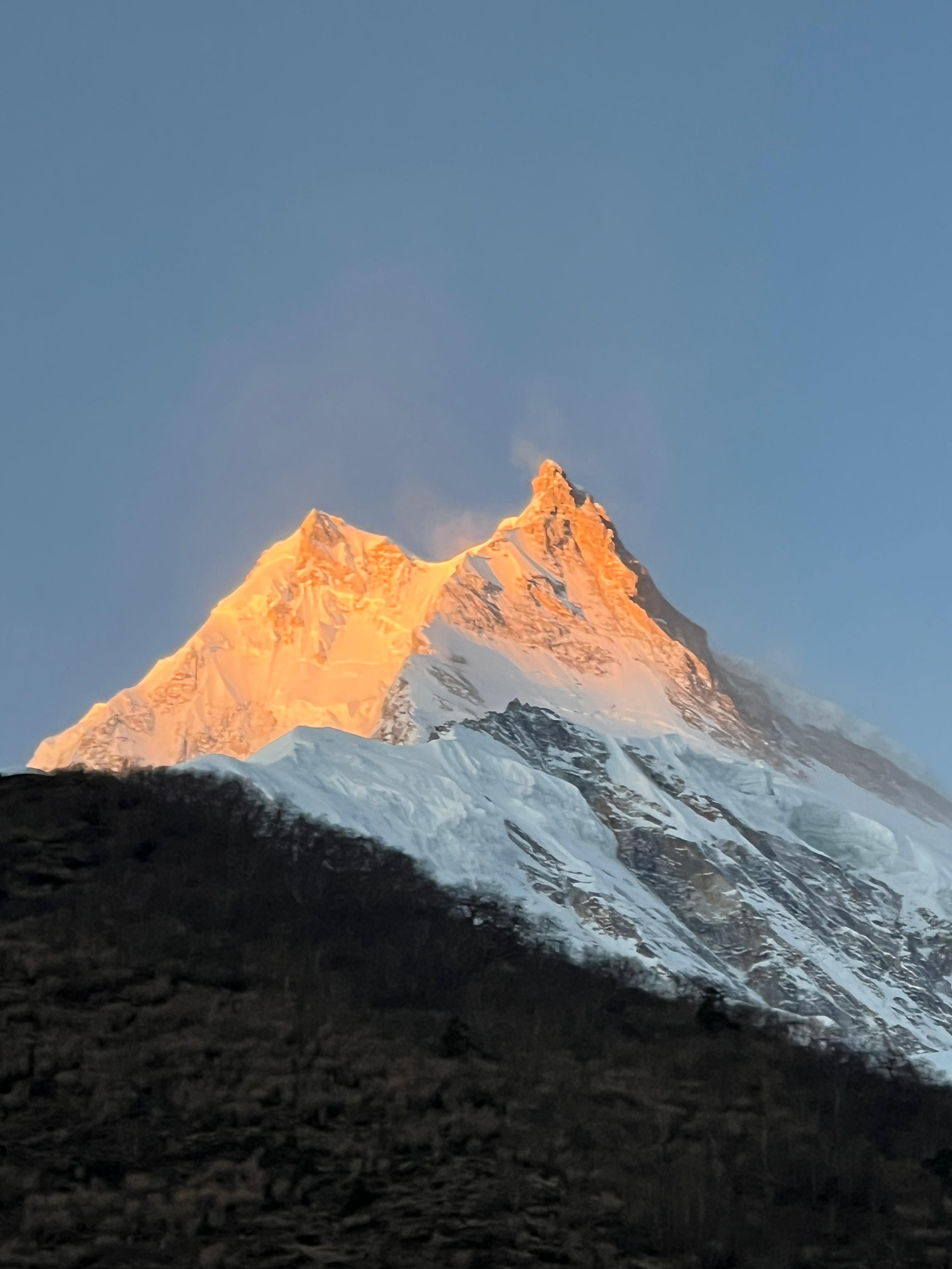
The scenery becomes much more dramatic here, with increasingly impressive views of the Manaslu range.
You may begin to notice small changes caused by altitude, such as slightly heavier breathing during uphill sections or a mild headache.
Don't panic if you feel the trail becoming harder. Instead, slow your pace and stay hydrated.
Lho sits at around 3,180 meters, marking an important transition into the high-altitude section of the trek.
Above 3,000 meters, the air is noticeably thinner. Walking uphill requires more effort, and you may need to take more frequent breaks.
Lho is also one of the best places to appreciate the massive scale of Mount Manaslu and the surrounding peaks.
Take your time here. The purpose of the trek is not to reach each village as quickly as possible.
Sama Gaun, at approximately 3,530 meters, is one of the most important stops for acclimatization.
Most well-planned Manaslu Circuit itineraries include an additional night here.
Instead of simply resting inside the teahouse, you can take a short acclimatization hike. Depending on your itinerary and conditions, options may include hiking toward Birendra Lake or exploring the surrounding valley.
The principle is simple:
Climb higher during the day, but return to sleep at a lower altitude.
This gives your body a chance to adapt while keeping the overnight elevation manageable.
Sama Gaun is also an excellent place to slow down and enjoy the unique culture, architecture, and mountain scenery of the region.
Manaslu Base Camp is located at roughly 4,800 meters or higher, depending on the route and reference point.
A hike toward Manaslu Base Camp from Sama Gaun is a popular acclimatization option for experienced and well-prepared trekkers.
The landscape becomes increasingly rugged, with glaciers, snow-covered peaks, and dramatic mountain walls.
However, don't treat this excursion as a race.
At nearly 5,000 meters, the amount of available oxygen is significantly lower. If you feel unwell, descending is more important than reaching the destination.
The trail continues toward Samdo, located at approximately 3,875 meters.
This is one of the highest permanent settlements on the route and lies close to the Nepal-Tibet border.
At this altitude, the effects of thin air are much more noticeable.
You may find yourself walking slowly and stopping more frequently. Even carrying a small daypack uphill can feel surprisingly tiring.
That's normal.
The best approach is to walk slowly, take short breaks, drink regularly, and avoid unnecessary exertion.
Dharamsala, or Larkya Phedi, is located at approximately 4,460 meters.
This is the last overnight stop before crossing Larkya La Pass.
For many trekkers, this is where the reality of high-altitude trekking becomes obvious.
The air is thin, nights are cold, and sleeping can be difficult.
You will generally arrive in the afternoon, have an early meal, prepare your gear, and go to bed early.
There is no reason to push yourself unnecessarily at Dharamsala. The following day is the most demanding day of the trek.
This is the highest point of the Manaslu Circuit Trek.
At 5,106 meters (16,752 feet), Larkya La Pass is a serious high-altitude environment.
The climb begins early from Dharamsala.
As you ascend, you may encounter snow, ice, strong winds, and freezing temperatures depending on the season.
The trail can feel deceptively slow. Your legs may still be strong, but your breathing becomes more difficult because of the reduced oxygen.
The secret is to maintain a steady pace.
Don't try to match the speed of another trekker. Take small steps, breathe steadily, and stop for short breaks when necessary.
Eventually, the prayer flags and summit of Larkya La come into view.
The feeling of reaching the pass after days of trekking is difficult to describe.
You have crossed the highest point of the circuit.
And then comes the descent.
After crossing Larkya La, the trail descends toward Bimthang at approximately 3,590 meters.
The descent provides immediate relief from the extreme altitude.
You also begin to notice changes in the landscape as the trail moves toward greener valleys.
Although the day is long, reaching Bimthang is a rewarding experience because you have completed the most challenging section of the Manaslu Circuit.
Altitude sickness can potentially affect anyone at higher elevations.
The risk generally becomes more relevant once you travel above approximately 2,500 meters, and the risk increases as you ascend.
Common symptoms of mild acute mountain sickness include:
These symptoms should not simply be ignored.
If symptoms are mild, your guide may recommend resting at the same altitude and monitoring your condition.
If symptoms become worse, do not continue ascending.
Severe symptoms such as confusion, difficulty walking, severe breathlessness, or rapidly worsening condition can indicate a medical emergency and require immediate descent and medical assistance.
There is no guaranteed way to completely prevent altitude sickness, but smart trekking practices can significantly reduce the risk.
Avoid trying to complete the Manaslu Circuit in an unnecessarily short number of days.
A slower itinerary gives your body more time to adapt.
This is one of the most valuable days of the trek.
Use it to explore the area at a comfortable pace and allow your body to adjust.
Drink water regularly throughout the day.
At high altitude, dehydration can make you feel worse and can contribute to headaches and fatigue.
You burn a lot of energy during a Himalayan trek.
Even if your appetite decreases, try to eat regular meals.
Dal bhat, noodles, soup, rice, potatoes, eggs, and other simple trekking foods can provide useful energy.
This may be the most important practical tip.
At high altitude, slow is efficient.
Don't try to maintain your low-altitude walking speed.
Alcohol can interfere with hydration and sleep and is best avoided during the higher sections of the trek.
The difficulty of Larkya La is not caused by altitude alone.
Several factors come together on the pass-crossing day:
High altitude: You reach more than 5,000 meters.
Thin air: Breathing becomes harder and walking speed decreases.
Cold temperatures: Early morning temperatures can be extremely cold.
Long trekking day: The journey from Dharamsala over the pass and down toward Bimthang takes many hours.
Changing weather: Mountain weather can change quickly.
Snow and ice: Depending on the season, sections of the trail may be covered with snow.
This combination makes Larkya La the most demanding part of the Manaslu Circuit.
If you have previously trekked in Nepal, it can be useful to compare elevations.
| Trek / Location | Approx. Highest Point |
| Langtang Valley Trek | 4,984 m |
| Manaslu Circuit – Larkya La | 5,106 m |
| Annapurna Circuit – Thorong La | 5,416 m |
| Everest Base Camp | 5,364 m |
| Everest Three Passes | Over 5,300 m |
The Manaslu Circuit therefore reaches a very high elevation, although the experience is different from each of these other treks.
The important thing is not simply comparing numbers. The rate of ascent, acclimatization schedule, weather, physical condition, and individual response to altitude all affect how difficult a trek feels.
You don't need to become a professional athlete before trekking Manaslu.
However, being physically prepared makes the journey much more enjoyable.
Start training at least several weeks before departure.
Include activities such as:
Focus on:
Try some longer hikes while carrying the backpack you expect to use during the trek.
The goal is to teach your body what several hours of walking with weight feels like.
Your equipment should be suitable for both warm lower valleys and freezing high-altitude conditions.
Essential items include:
A good sleeping bag is particularly important because temperatures can fall sharply at higher elevations.
The main trekking seasons are spring and autumn.
March to May offers warmer conditions and excellent mountain scenery.
April and May are particularly popular because the weather is generally favorable and rhododendrons add color to the lower sections of the route.
September to November is another excellent period.
October is especially popular because the monsoon has usually cleared the atmosphere, creating excellent mountain visibility.
At higher elevations, however, mornings and nights remain cold.
December to February can bring heavy snow and extremely cold conditions.
Larkya La may become difficult or inaccessible during periods of heavy snowfall.
June to August brings rain to the lower sections, which can make trails muddy and slippery.
Landslides and wet conditions can also affect transportation and trekking conditions.
What is the maximum altitude of the Manaslu Circuit Trek?
The highest point is Larkya La Pass at approximately 5,106 meters (16,752 feet).
How high is Sama Gaun?
Sama Gaun is approximately 3,530 meters (11,581 feet) above sea level.
How high is Dharamsala?
Dharamsala, also called Larkya Phedi, is approximately 4,460 meters (14,633 feet).
Is Manaslu Circuit Trek dangerous because of altitude?
The trek involves genuine high-altitude risks, particularly above 3,000 meters. However, proper acclimatization, a gradual itinerary, sensible pacing, and experienced guide support can significantly improve safety.
Can beginners do the Manaslu Circuit Trek?
Yes, physically fit beginners can complete the trek with appropriate preparation and a properly designed itinerary. Previous high-altitude trekking experience is helpful but not essential.
How many days does it take to acclimatize on Manaslu?
Most itineraries include an acclimatization day around Sama Gaun. The exact schedule varies according to the itinerary, pace, weather, and individual needs.
Is Larkya La Pass harder than Everest Base Camp?
They are difficult in different ways. Larkya La reaches approximately 5,106 meters, while Everest Base Camp is around 5,364 meters. The Manaslu pass crossing involves a long, high-altitude day with a significant climb followed by a substantial descent.
Can I get altitude sickness on the Manaslu Circuit?
Yes. Altitude sickness can affect trekkers regardless of age or fitness level. The risk increases as you climb higher, particularly above 3,000 meters.
What should I do if I develop altitude sickness?
Tell your guide immediately and stop ascending. If symptoms worsen or become severe, descending to a lower altitude is the priority. Serious symptoms require urgent medical attention.
The Manaslu Circuit Trek altitude is what makes this adventure both challenging and unforgettable.
You begin the journey surrounded by green hills and rushing rivers at around 900 meters. Days later, you are walking through a completely different world above 4,000 meters, surrounded by glaciers, snow-covered peaks, and the enormous Manaslu range.
The biggest challenge comes at Larkya La Pass, 5,106 meters above sea level.
But you don't have to rush toward that number.
The best Manaslu experience comes from taking the journey slowly, allowing your body to acclimatize, staying hydrated, eating well, listening to your guide, and respecting the mountain.
Altitude should never be treated casually, but it should not stop you from experiencing one of Nepal's most spectacular trekking routes either.